
Gregory David Lue, MASc thesis, Civil Engineering, 2017
Professor Eric J. Miller, Supervisor
Summary
One goal of city planning is to promote walkable cities and high quality public spaces. While the route choice behaviour of car drivers and transit users are well-studied problems, how pedestrians choose their routes, and how street design affects these choices, is much less understood. If we want to plan for cities that encourage walking, we need models that can better predict how pedestrian mode and route choices depend on street and neighbourhood design. A major obstacle to developing such improved models is the difficulty in collecting large amounts of detailed data of pedestrians’ actual route choices.
This study uses GPS data collected through a smartphone travel survey and a pedestrian route choice model to determine pedestrians’ preferences towards street infrastructure, the built environment, and land use. This study is an important stepping stone towards gathering large datasets of pedestrian data and gaining a better understanding about how to make our neighbourhoods more walkable. Figure 1 illustrates one of the GPS trips collected in the survey.
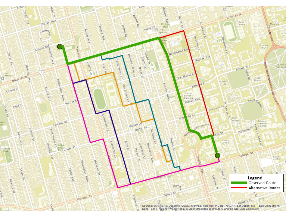
The thick green line represents the route chosen by one person in the survey. The thin lines represent alternative routes generated by pedestrian route choice model. It is found that people avoided routes with more turns and generally travelled on routes with more signalized intersections and sidewalk infrastructure.
In terms of distance equivalents, each turn is equivalent to an additional 32m to the route length, signalized intersections are equivalent to a reduction of 34m, and travel along streets with sidewalks on both sides of the road is perceived as 33% shorter than streets with other sidewalk conditions.
Supervisor contact information
Professor Eric J. Miller
Tel: 416-978-4076
miller@ecf.utoronto.ca