
Jeffrey J. Allen, MA thesis, Geography, 2018
Professor Steven Farber, Supervisor
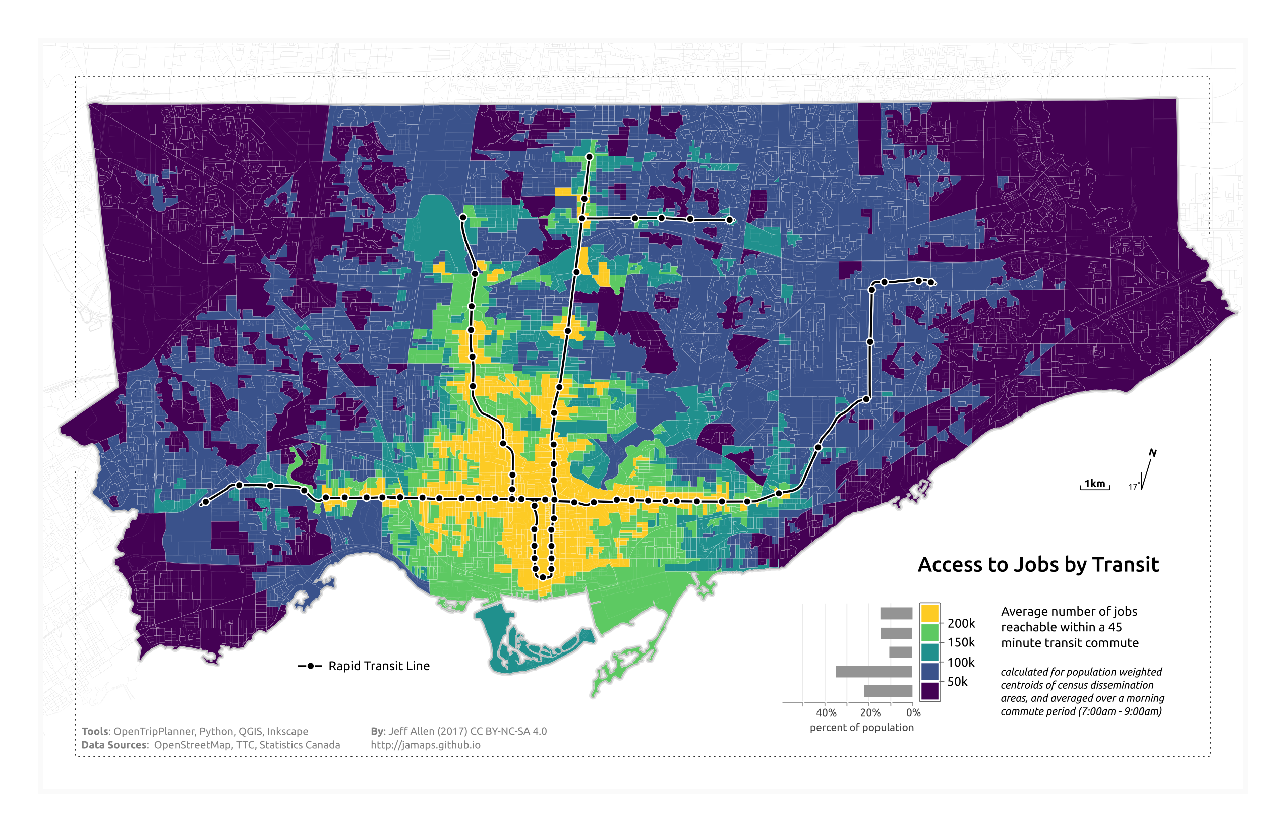
Summary
Public transit is critically important to lower income urban Canadians. It’s essential for finding a job, travel to work, and for getting around the city in general. Poor transit access, combined with other forms of social and economic disadvantage (e.g. poor health, not being able to afford a car, etc.), can result in transport poverty, limiting the ability to travel to and participate in daily activities.
This research measures transit accessibility in Canada’s eight largest urban regions in order to analyze inequalities in transit access and to estimate the extent Canadians are at risk of transport poverty.
Research findings show:
- Lower income areas are generally more centrally located and have relatively higher levels of transit access.
- Despite this overall positive outlook, a million low-income Canadians still live in areas with low transit access.
- Improving transit in areas that are currently both low-income and have low levels of transit access can reduce risks of transport poverty.
Supervisor contact information
Professor Steven Farber
Tel.: 416-287-5607
steven.farber@utoronto.ca